Three Months / Three Walks, in preparation of…
on December 14th, 2011 at 14:08…The Three Peaks…of Yorkshire!
{YES! Again!}
It’s no secret of my willingness to tackle Ribblesdale’s arduous and infamous twenty five (or thereabouts) mile and three peak challenge over the mountains of Pen-Y-Ghent, Ingleborough and Whernside (in ascending order of height).
I attempted it in 2010 and abandoned at Ribblehead owing to lack of preparation and fitness (For a late spring day the weather was atrocious!). Since then I have vowed to do it on a number of times as part of a group but nothing has materialised. Eventually, have rounded up the same group of hardy volunteers whom took part with me in 2010 and coerced them into committing to a date in June 2012.
Now having already completely made a pig’s ear of my last attempt, I am getting really serious for this attempt and have planned a number of training routes – as I did in 2009/10. I have already been a none-smoker now for the last fifteen weeks, have stopped eating the skin off roasted chickens and am beginning to (finally) take my health seriously. This time however the idea will not be to set myself ridiculous tasks such as going up and down Pendle twice in the same walk! (I did it, but my word did my feet suffer the day after!) This time I am picking achievable targets.
And they are:
-
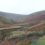
The Circuit of Pendle Hill
From Barley visitor centre
I shall walk up Cross Lane and then down into Newchurch-in-Pendle passing by Witches Galore and Saint Mary’s Parish Church. Then I’ll head along the peaceful and scenic Wellhead Road, over the unbelievably steep Saddler’s Height and then through the eerie yet captivating Fell Wood. Now having descended the tiny steps that lead to the bridge which will take me over Lower Ogden Reservoir,I shall start to make my way uphill by passing Upper Ogden Reservoir to reach the bottom of Boar Clough. Then it’s onwards and upwords to the summit at Big End. Next I shall turn 270 degrees head back towards Boar Clough but turn off left in order to take the grit-stone path back down to the base of the Barley Steps at the back of Pendle House but avoiding the steps (I hate those bloody steps!). From here it is a gentle stroll back to Barley visitor centre via Ing Head and Ing Ends.Distance = about six and three quarter miles. I aim to do this on Sunday January 29th.
View Pendle Hill Tour on 30th Oct 2011 in a larger map -
Rambling around Rivington
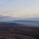
This one starts at the Rivington Hall Barn car park but oddly enough Rivington Pike is the last summit covered on this seven peak stride where good weather is essential! I will head off down Sheep House Lane towards Parsons’ Bullough Road over Alance Bridge and onto Moor Road. This now becomes a bit of a long drag as for the next mile and an half as we head up then downhill towards White Coppice ultimately turning right through a large gate just outside of the hamlet. The path now leads us along a sheep-filled common for some distance before filtering off left for the ridiculously tough stretch which will lead up towards Great Hill (our first summit!) via DrinkWaters and a few deserted farms.
The path by now has become far more gentle as we reach the summit of Great Hill with its’ impressive stone shelter the views open up in all directions. For now it is a twenty minute march downhill towards Redmonds and then up Spitlers’ Edge (our second and third summits). Here is where the good weather factor comes into play as the descent of Spitlers is a tricky affair where the going after a good downpour is just awful! After the Spitlers slide I’ll cross the Belmont Road towards Hordern Stoops whilst cringing at the prospect of the climb ahead of me…until I turn passed the difficult and steep trek that is the northern face of Winter Hill and turn right towards Rivington once more. After a few hundred yards another turn off on the left hand side appears, I’ll go through the gate here heading slightly uphill and passing yet another left turn which if followed would take me steeply up towards Winter Hill. The next left hand turn-off is the one to take as this will lead us to our fourth summit of the day, the oddly named “Noon Hill”, then following a more or less due west line on to the trig point at Winter Hill – our fifth summit and the apex of the walk in all sense of the word!
From here the end is in sight, but for the most part that dry weather which we so require is going to be an asset! The walk straight down “Winter Hill” road is not in any way a challenge, the crossing of the peat moorland in order to cut across Crooked Edge Hill and to Two Lads (our sixth summit!) is at best, messy, at worst one could possibly sink to one’s knees here if the weather has been bad enough. The descent is a brief and bumpy one following the path that naturally opens out in front of me and leading me to a tiny flight of sandstone steps with the Rivington / Blemont Dog Hotel on my right hand side. Turn right here and wind one’s way up another instance of Belmont Road. The going underfoot from here and for the next few hundred yards is somewhat hard, cruel would be a better description as essentially we are walking on a road that is a mixture of cobbles and sandstone. Eventually after heading slightly uphill a right hand turn-off over Brown Hill (not on our summit list as it is rather indefinable!) will lead us to the bottom of the final climb up the northern aspect of Rivington Pike. This is by far and away the steepest ascent on the walk (because we didn’t do Winter Hill from the north!) and I would imagine that after a few days of rain that this route up the pike could teeter towards treacherous – but still more enjoyable than the multitude of steps 180 degrees around the hill that we shall be descending after stopping atop the pike to admire the spectacular 180 panorama. At the bottom of the steps cross the same Rivington / Belmont Road that has accompanied us at varying points throughout the day, keeping the toilet block on your right hand side, drop down the multitude of paths that ultimately lead one out at varying points on the lane to the car park or at the back of Rivington Barn Hall.
The distance is anywhere between 10 and 13 miles according to Google Maps and I aim to do this on Sunday the 26th of February 2012.
View All Around Anderton in a larger map -
Pen-y-Ghent to Ribblehead and back
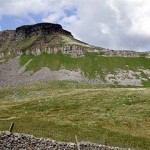
Well, seeing as this was effectively the walk that I did when I aborted the main three peaks walk in May 2010 then it seemed like a poignant conclusion for my preparation of the 2012 three peaks walk. (Although in honesty I will probably be walking most weekends if only locally; in-between the end of this walk and the event itself in June.)The walk starts at the overflow car park just off the B6479 around the back of the Crown Inn Hotel. I shall head towards the Pen-y-ghent Café, cross the road and head off uphill towards Brackenbottom farm. Over the stile and into very steep terrain that is occasionally broken up by some easy scrambling over limestone. After a mile and an half (or thereabouts) and a number of steps and stiles the path joins with the Pennine Way as it meanders up the south west face of Pen-y-Ghent. There are two notable steep sections during the climb up to the summit but the last five hundred yards is a delightful parade up to the ordnance survey column.
Over the stile we go and hopefully the drop down the side of Pen-y-ghent won’t involve me falling over as it has on the previous two occasions! When the Pennine Way path forks off to the left to head back into Horton I shall bear right and head in the general direction of the mosses (Red and Black Dub). For the next six miles it will be a mixture of slippery grass over limestone, undulating mounds, occasional good quality grit-stone paths and the almost ever-present mud, always lurking and waiting to splatter me in highly visible places!
The walk back will be a much less arduous task – albeit a far less scenic one as far as my immediate environment goes. At what has become known to be as “The Fourth Peak” – an hot food and beverages van that is parked at Ribblehead on bank holidays and weekends, I shall turn around and pretty much head back to where I came from via the B-road back into Horton In Ribblesdale.
If however, my feet,legs and back are feeling fine then I won’t do this and instead will turn the walk into a four peak challenge as I head off towards Park Fell in order to climb this fell, traverse Simon Fell and then the easier route up Ingleborough before doing another about turn and heading off over Simon Breast Fell and Sulber Nick back into Horton In Ribblesdale. Some might say that if you are going to go to those lengths then surely wouldn’t it be just as well to do the 3-peaks walk in proper? They would have a point, but for me the messing about to get up Whernside is far greater than the expenditure of energy that it will take to get up Park Fell (which is not as high as say Pendle Hill) and across Simon Fell (which is up a slope so slight that it borders on insignificant!). The aim of the practice or training walks is to achieve the achievable – not to set myself silly goals and for me to attempt all three peaks at the end of March (when I plan on attempting all three at once). In summing, I will be walking up and down Pen-y-ghent and onto Ribblehead then back in Horton in Ribblesdale via a scenic and strenuous route or via tarmac and concrete roadside pavements.
The date for this walk should be: Sunday the 25th of March, 2012


Recent Comments